
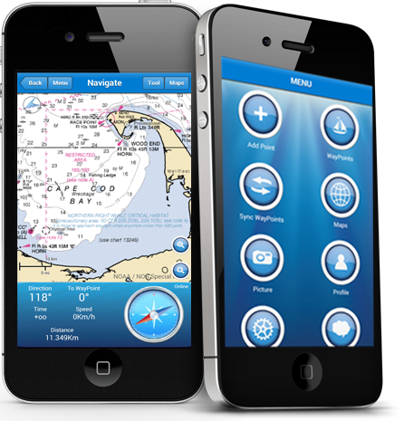
MARINE NAVIGATION
Find your road on the sea! GPS chartplotter for your boat.
An easy-to-use offline GPS tracker and route planner featuring worldwide offline maps.
Wherever you are: sea, rivers or lakes it will help you find your way.
Not only an app but an affordable tool for fishermen, sailors or just water sports passionates.
MAPS AND MARINE CHARTS
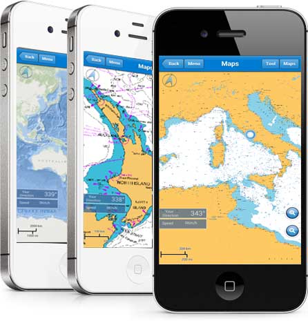

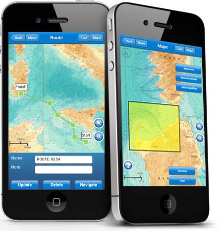
MAPS OFFLINE
You can download maps or marine chart, you need select area and application save tile in the disk. You can navigate on preloaded maps or chart without connection.
Marine Navigation is powerd by:
National Oceanic and Atmospheric Administration (NOAA),
Marine Navigation use NOAA RNC raster United States waters marine charts
National Oceanic and Atmospheric Administration (NOAA), Marine Navigation use Bathymetric
Mediterranean RNC (Raster Navigational Charts)
NZMariner is the product name of New Zealand’s Official RNC (Raster Navigational Charts)
Esri created and released a new, comprehensive map of the world’s oceans and coastal areas
This world topographic map includes boundaries, cities, water features, ports, physiographic features, parks, landmarks, transportation, and buildings.
This map service presents satellite imagery for the world and high-resolution imagery for the United States and other areas around the world.
Open Sea Map is a first opensource maps for the sea, with ports, sea light and more.
FEATURE
FUNCTION
- Navigator GPS
- Sync Route/Waypoints
- Interactive Map
- Deep Chart / Altitude Chart
- Active Pointer
- Create, Manage and Delete Route/WayPoints
- Way Tracking
- Share Image
- Anchor Alert
- Code Morse
- Moon Info
- 4000 SeaPorts
- Scale Interface
- Screen Alive
LANGUAGE
- British
- Italiano
- Français
- Espagnol

SOCIAL
Create your Yacht Club.
Share or import Points.
Make the best Marine Navigation group.
Social Function
Login with Facebook Account
Group (Public, Password, Invite)
Create Your Group
Archive Points
Group Live Chat
Group Share Image
Admin Your Group
Share WayPoints
Import/Export Points
You have the power, power to choose Marine Navigation for your adventure